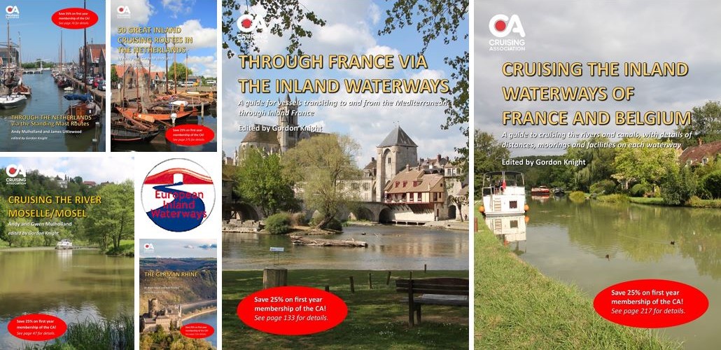
The Cruising Association (CA) is pleased to announce the publication of the new and updated 2024 editions of its comprehensive European Inland Waterways Cruising Guides.
Available in full-colour print and digital formats and published by the CA's European Inland Waterways Section (EIWS), these guides provide invaluable insights for those navigating the intricate waterways of France, Belgium, the Netherlands, the River Moselle/Mosel, and the German Rhine.
The CA is offering a special Christmas discount of 25% on the digital versions of these guides from 1-31 December 2023. The digital editions contain numerous hyperlinks to useful sources of information, along with links to the CA's award-winning app, CAptain's Mate, enabling members to access the most up-to-date information on mooring locations.
In addition to the purchase price discount on the digital versions, every guide includes a special 25% off discount code for the first year's CA membership when paying by Direct Debit. This discount is included with all guide purchases up until 31 December 2024 and must be redeemed during 2024.
The guides, which are produced in digital and printed format by the CA's European Inland Waterways Section (EIWS), include Cruising the Inland Waterways of France and Belgium (£31.50 plus p&p); Through France via the Inland Waterways (£22.50 plus p&p); Through the Netherlands via the Standing Mast Routes (£15 plus p&p); 50 Great Cruising Routes in the Netherlands (£35 plus p&p); Cruising the River Moselle/Mosel (£12.50 plus p&p) and The German Rhine £8.50 (plus p&p).
The new editions reflect the updates that have been posted by EIWS members cruising the inland waterways during 2023. All six are available in both full colour print and PDF digital format via the Cruising Association's online shop, where CA members can also download the digital versions free of charge.
For further information on the full range of the CA's inland waterways publications, visit the European Inland Waterways Section web page.
About the Guides:
- Cruising the Inland Waterways of France and Belgium (edited by Gordon Knight) - described as their 'Bible' by those planning passage to/from the Mediterranean, this guide is packed with information on routes, preparations, supplies, equip-ment, licences, documents, useful addresses, books and websites, and lists around 250 mooring places.
- Through France via the Inland Waterways (edited by Gordon Knight) - aimed at moderate draught (up to 1.8m), this guide contains the information and preparations required to transit any of the four principal routes to the Med, including equipment, licences, documentation, sources of navigation, managing locks, supplies, moorings and more, along with 100+ hyperlinks to port/marina/boatyard and other websites.
- Through the Netherlands via the Standing Mast Routes (by CA members Andy Mulholland and James Littlewood and edited by Gordon Knight) - provides detailed navigation information on 14 different transit routes in the Netherlands, spanning nearly 1,000kms of waterways from Vlissingen near the Belgian border to Delfzijl close to the German border.
- 50 Great Cruising Routes in the Netherlands (by CA members Andy and Gwen Mulholland and edited by Gordon Knight) - presents 50 cruising routes across the Netherlands, with detailed information and step-by-step navigation details, bridge and lock, moorings and facilities, along with sources of information on every aspect of Netherlands cruising.
- Cruising the River Moselle/Mosel (by CA members Andy and Gwen Mulholland and edited by Gordon Knight) - covering the 394kms of the river from Neuves-Maisons in France through Luxembourg and Germany, to join the Rhine at Koblenz, this guide includes step-by-step navigation details for the river, including distances, bridge heights, lock dimensions and VHF channels, descriptions of moorings and fa-cilities, and information on visitor attractions enroute.
- The German Rhine (written by CA members Dr Roger Edgar and Rob Thomas and edited by Gordon Knight) - covers about 725km, from the start of the navigable reach of the river at Rheinfelden to Nijmegen, just inside the Dutch border. Covering hazards and highlights, the guide includes a detailed list of mooring points, fuel stations, ports and harbours, useful websites and sources of commercially published information.
1 December 2023